About CoGIS platform
CoGIS - geographic information platform
CoGIS is an infrastructure vertically integrated digital platform that allows you to:
- Organize web access to spatial data and geoprocessing functions through map services.
- Ensure compatibility with various client applications, information systems and infrastructures through Rest API and adapters for the most popular web mapping protocols, such as TMS, WMS, WFS, WMTS and AGS.
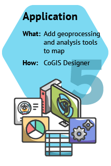
- Extend progressive map rendering capabilities with custom filters, settings, and time-enabled layers, as well as geoprocessing and analysis tool widgets.
- Organize the regulation of access to maps, services, layers, individual objects and territories for certain users and user groups via unified identification and authentication system and social networks.
Platform components

Creation of full-fledged cartographic web applications based on cartographic services, geoprocessing and analysis tools, customization of the structure and content of the geoportal that does not require programming skills.

Publishing vector and raster map data and geoprocessing tools as web services.

A single point of user access to published interactive maps, mapping web applications, web pages, documents, links to external sources.

Working with published offline and online maps and web applications on Android and iOS mobile devices, using the mobile layout of the web portal and convenient mobile applications.
From data to services and applications
High performance and stability
Our GIS server has high map rendering performance, which is crucial for publishing rich dynamic data. Due to smart resource usage optimization, GIS server allows you to publish hundreds of services on a single server.
The GIS server supports fast construction of a tile cache based on specified scales and areas (including determination of extents through a polygon layer), creation of tiles on the fly, and the ability to update the tile cache upon data changes.
In addition, our GIS server offers other geodata visualization capabilities, such as feature clustering, heatmapping, cropping image by tolerance zone, etc.
A customizable service isolation mode improves the overall stability of the GIS server and ensures smooth running of the entire infrastructure.
Visual analysis tools
CoGIS provides a wide range of features and tools for visual data analysis, for example:
- building heat maps on the fly
- server clusterization as pie chart with relationships
- building clusters based on attribute (for example, by region or district)
- drawing features by categories, ranges and rules
- comparison of selected layers and basemaps using the "swipe" tool
- spatial and attribute filters
- symbols as diagrams
- auto-refreshing layers to display dynamic data
- features filtering slider by dates
- dynamic representation layers based on SQL queries
- symbols as centroids of polygonal features
- custom layer coloring
The GIS server supports working with spatial data stored in the PostgreSQL (PostGIS) and Microsoft SQL Server DBMS, as well as with files in vector and raster formats.
The data import and export tools work with all supported formats. Many of them are available for direct reading with display on the map, published as map services.
The data transformation is also available in geoprocessing tools that can be used in models, published as geoprocessing services, and used in web mapping applications.
The supported vector data formats are Shapefile, GeoPackage (vector data), KML, GPX, GeoJSON, SXF (Panorama), DWG and DXF (AutoCAD), TAB/MIF/MID (MapInfo), File Geodatabase (ArcGIS), CSV, ArcGIS XML, etc.
The supported raster data formats are GeoTIFF, TIFF, JPEG, PNG, GeoPackage (raster data), MrSID (Extensis/LizardTech), etc.
Smart editing
CoGIS provides a large set of tools for creating and editing features through web browser and mobile app.
|
|
TrueDrive is the CoGIS module provided for performing various analysis on road networks.
TrueDrive includes such algorithms as calculation of shortest route and building service areas. The calculation optimization can be carried out by distance, time, or another parameter (danger, entertainment, etc.)
At the same time, the prohibitions and penalties for turns, barriers, competitive zones, etc. can be used in the calculations.
Reporting system
The reporting system implemented in CoGIS allows you to create complex reports in Word and Excel formats without programming skills.
You can add feature characteristics, statistics calculations, insert images and map fragments, spatial analysis results, as well as information related to feature location (coordinates, address) or feature geometry (area, perimeter, etc.) to your reports.
Reports are generated for features and/or lists of features from one or more feature classes based on Word and Excel document templates.
Create geoprocessing models
A geoprocessing model is a visual representation of a workflow where multiple geoprocessing tools are run in succession, with the output of one tool becoming the input to another. Geoprocessing models can significantly simplify or automate performance of various tasks, and the process of creating them is so simple that it is accessible to any user without special skills.
Depending on the task, you can use the ready-made CoGIS geoprocessing tools (for now, there are about 100 geoprocessing tools available) or your own tools for creating models.
CoGIS provides the forward and reverse geocoding capability for finding location by address or getting address from coordinates. In mapping applications, this capability is used to perform the following operations:
- search for addresses on the map
- automatic address substitution when creating feature on the map
- creation of point feature by address specified in characteristics
- automatic determination of feature location on map by addresses when importing from Excel file
- selection of route points and service points when building optimal routes and service areas.
CoGIS Mobile app
CoGIS geoportal provides a layout for mobile devices which allows you to use CoGIS functions directly from the browser of the mobile device. For ease of use on mobile devices, a mobile application CoGIS Mobile has been developed.
CoGIS Mobile is the application for fully-featured work with published maps, navigation and data collection regardless of the Internet connection. The application is available for Android and iOS mobile devices and can be downloaded from Google Play and App Store, respectively.
CoGIS Mobile allows you to:
- Use offline basemaps to search and identify features in the field
- Create and edit features offline, at that upon reconnection to network all made changes are automatically sent to the server in the geodatabase
- Record GPS tracks, track location of the field workers devices on the map.
Widgets and statistics
You can add widgets to the map with the results of statistics calculations for map service features as graphs, charts, tables, or calculated indicators.
For example, widgets based on JavaScript plugins can call any external tool or service, and widgets with HTML code are used to display reference information about map features. All widget blocks are associated with features on the map, participate in filtering, are updated when editing, by map extent or by timer. Thus, you can significantly expand functionality of your maps, including using the CoGIS API.
Other platform features
- Work with any coordinate system, including geographic transformations
- Support for transformations between different geoids of different coordinate systems
- Measurement of distances and areas on the map and on the geometry of features
- Support for external basemaps, such as Yandex, Google, ArcGIS, Here, 2GIS, OSM, Bing
- Support for various types of authentication: login/password, social networks, etc.
- Automatic user registration with administrator notification
- Building the shortest routes and service areas
- Support for multilingual portal and web applications
- Printing maps using templates with marginal design
- Uploading and downloading data in Excel with full and partial data update
- Image gallery with callouts and filters
- Dynamic links to the map for sharing, integration, insertion into email templates


Operating systems: Linux (Ubuntu, Debian, CentOS, RHEL, etc.), Windows Server
Requisite web servers: NGINX, Apache, IIS.
Supported DBMS: PostgreSQL (PostGIS), Microsoft SQL Server, Oracle Database.