What's new in CoGIS 11?

We are pleased to announce the release of the new version of our geoinformation platform, CoGIS 11, introducing new features and tools, updates to existing functionality, improved user interface, and bug fixes. This article provides details of the selected updates of the new version.
CoGIS 11 presents various updates, including integration with LDAP, ability to create geoprocessing tools in Python, improvements in the user interface of the platform applications, and more. In this article we will focus on selected updates and tell you about them in a little more detail.
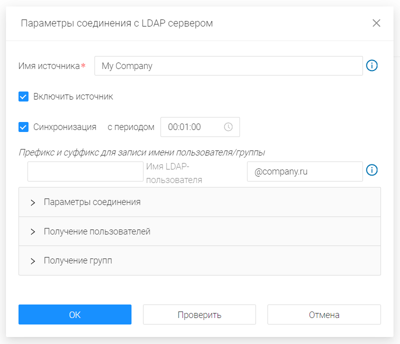
Integration with LDAP/Active Directory
One of the most popular functions of any system in the IT infrastructure is integration with the corporate LDAP directory system. This protocol is supported by both Windows and Linux systems, including domestic OS. Integration with LDAP allows you to simplify and better control management of access rights to resources within CoGIS platform via centralized directories using standard tools for administrators.
With this LDAP integration, the users can log in to the system via corporate domain accounts, and administrators can assign access rights to individual users and corporate domain groups.
The Windows infrastructure supports access to Active Directory via the LDAP protocol.
TrueDrive functionality included in CoGIS
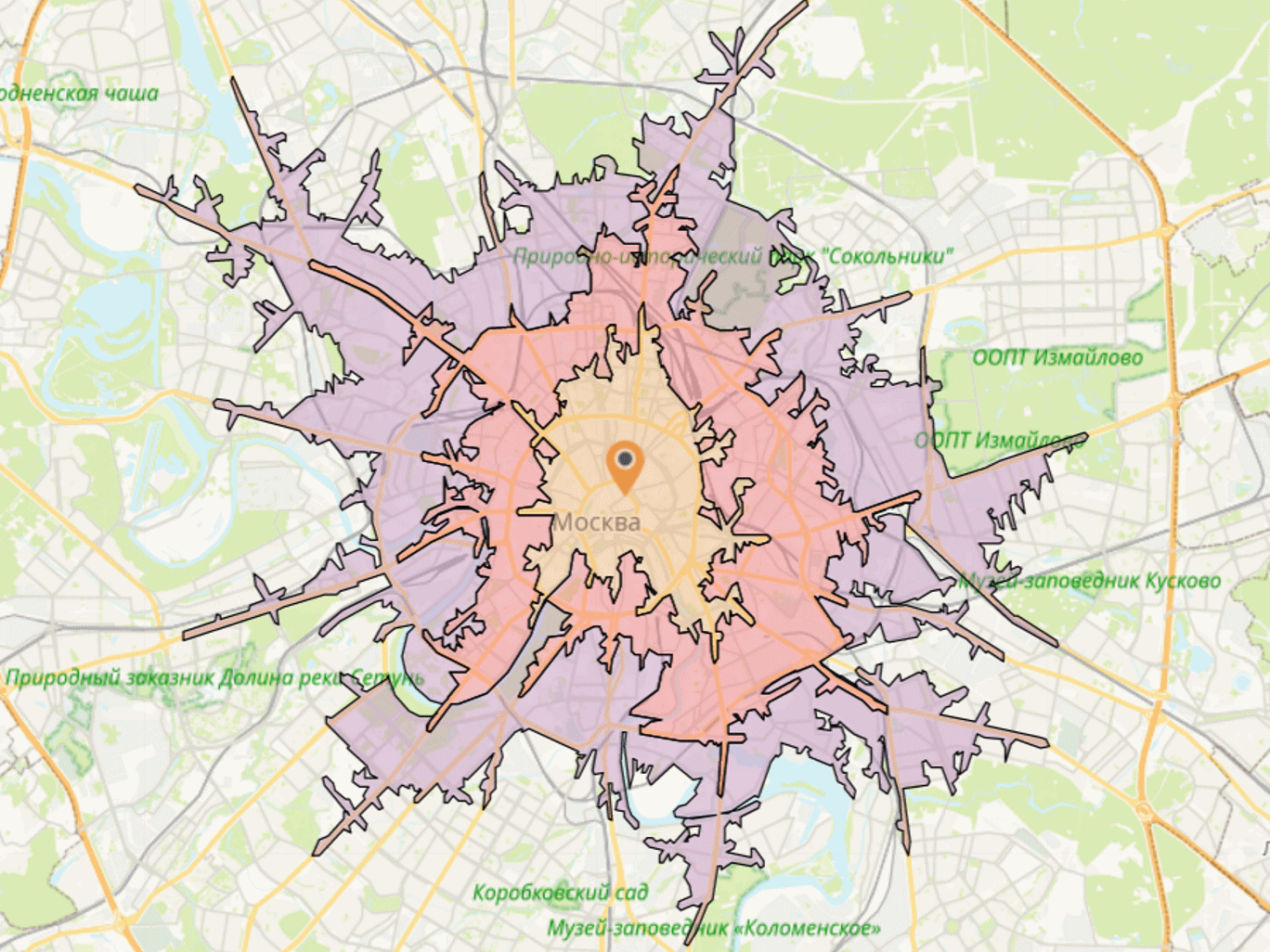
The functionality of the TrueDrive network analysis module is now a part of CoGIS platform. By purchasing CoGIS Enterprise license, you can integrate the road network calculation algorithms in your map applications. The available algorithms are optimal route calculation and service area calculation.
Updated reports generation system
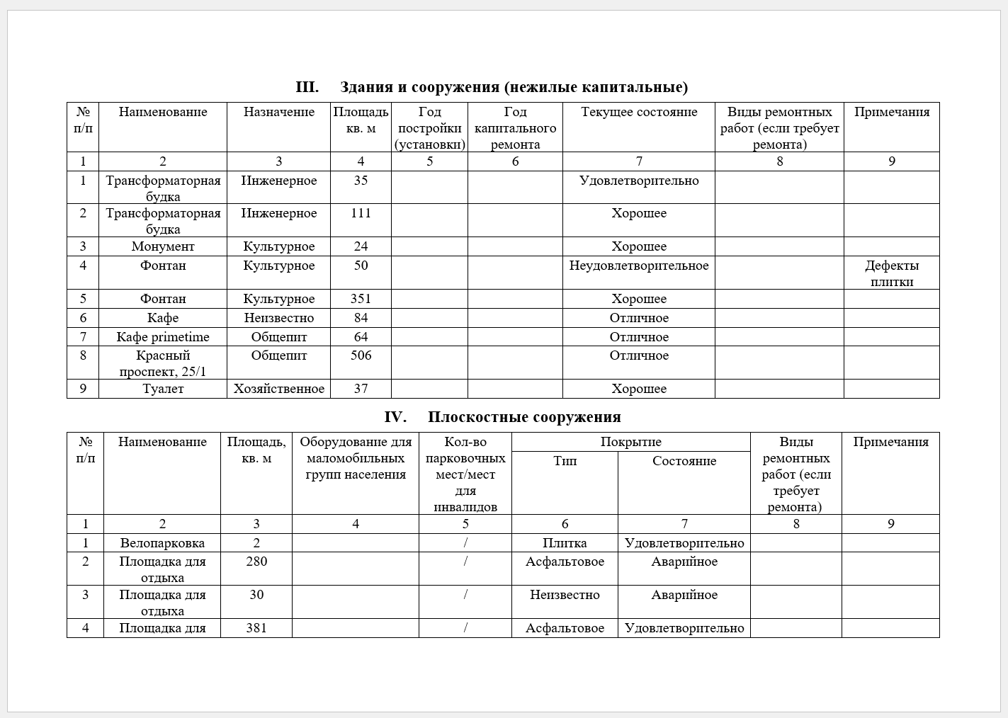
The automatic reports generation functionality is being used in various map applications built on CoGIS platform. CoGIS 11 introduces significant improvements to this option, enabling to expand capabilities of GIS experts on setting up the industry specialist’s workspace. In particular, the ability to create additional reports on subordinate objects, including them in the general report, has been added. The new structure of the general report also allows you to insert a map fragment to the report on a selected subordinate object.
Built-in display styles of TAB, MIF/MID, DWG, DXF
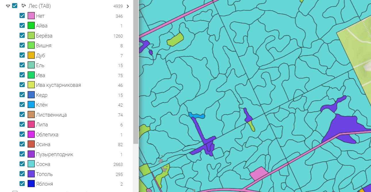
In some formats, such as TAB and MIF/MID, the objects coloring is preserved when uploading. In CAD files of DWG and DXF formats, the settings for objects display styles are also preserved.
The new version introduces support for built-in styles when reading TAB, MIF/MID, DWG, DXF data. That is, all styles are automatically converted to coloring of layers by unique values, which is shown when displaying the legend.
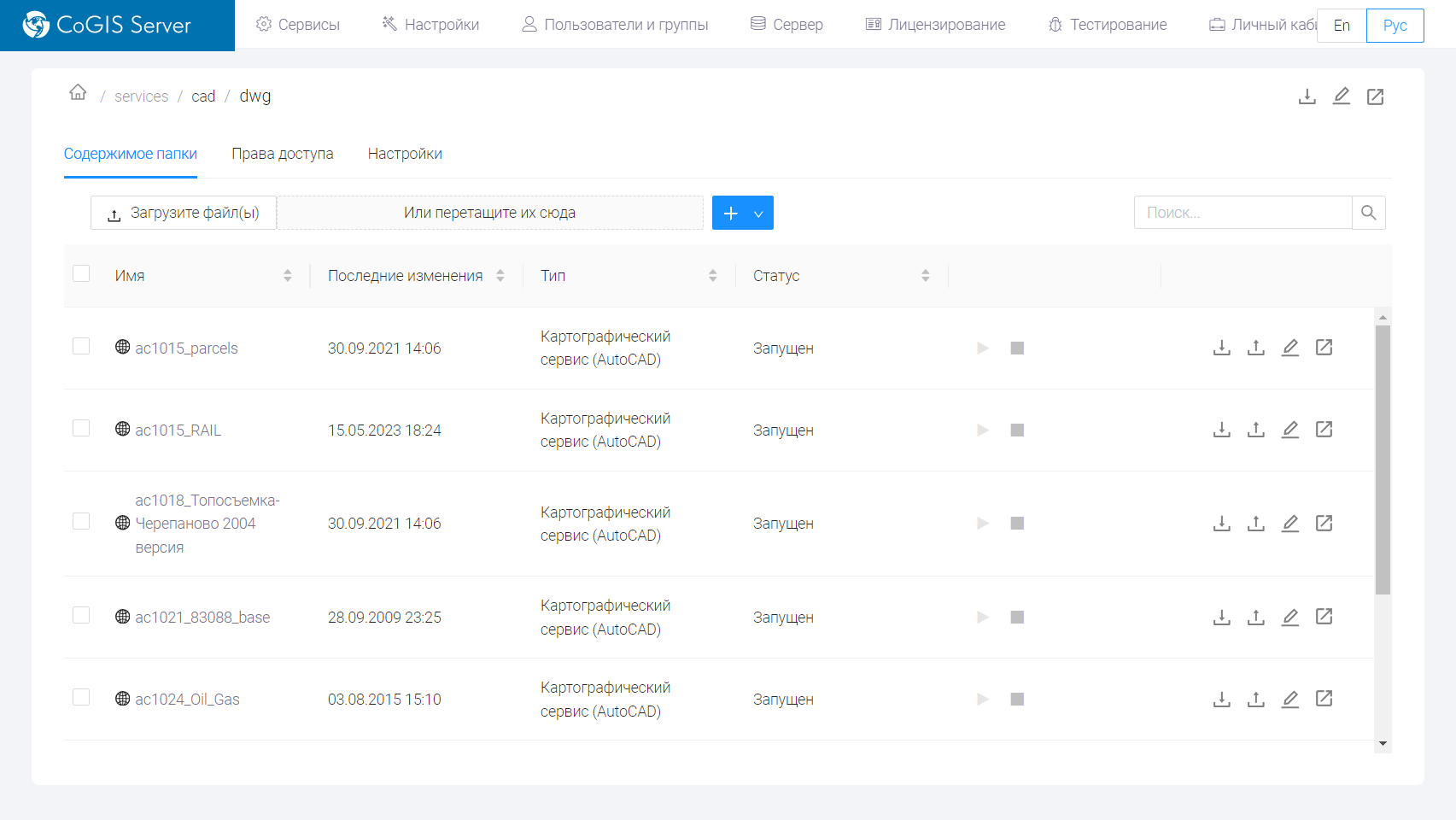
Publishing services based on CAD files
The new version implements the ability to publish services based on DWG and DXF files. Now data in CAD formats can be quickly published as map services preserving the internal rendering styles.
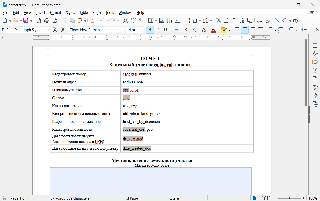
Support for creating report templates in LibreOffice
Starting from CoGIS 11, the LibreOffice software package can be used to create and edit report templates.
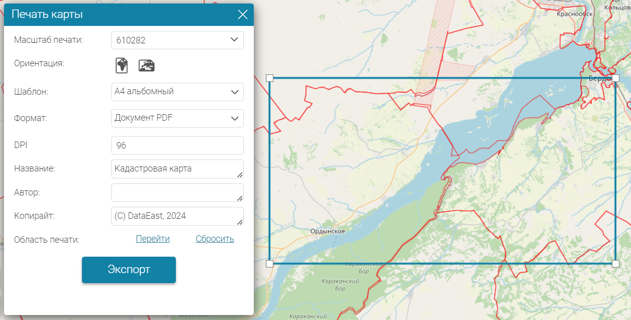
Print templates
The new version allows you to customize print templates in QPT format. Now you can use map elements, legend, scale bar, text captions, etc. in the print document template.
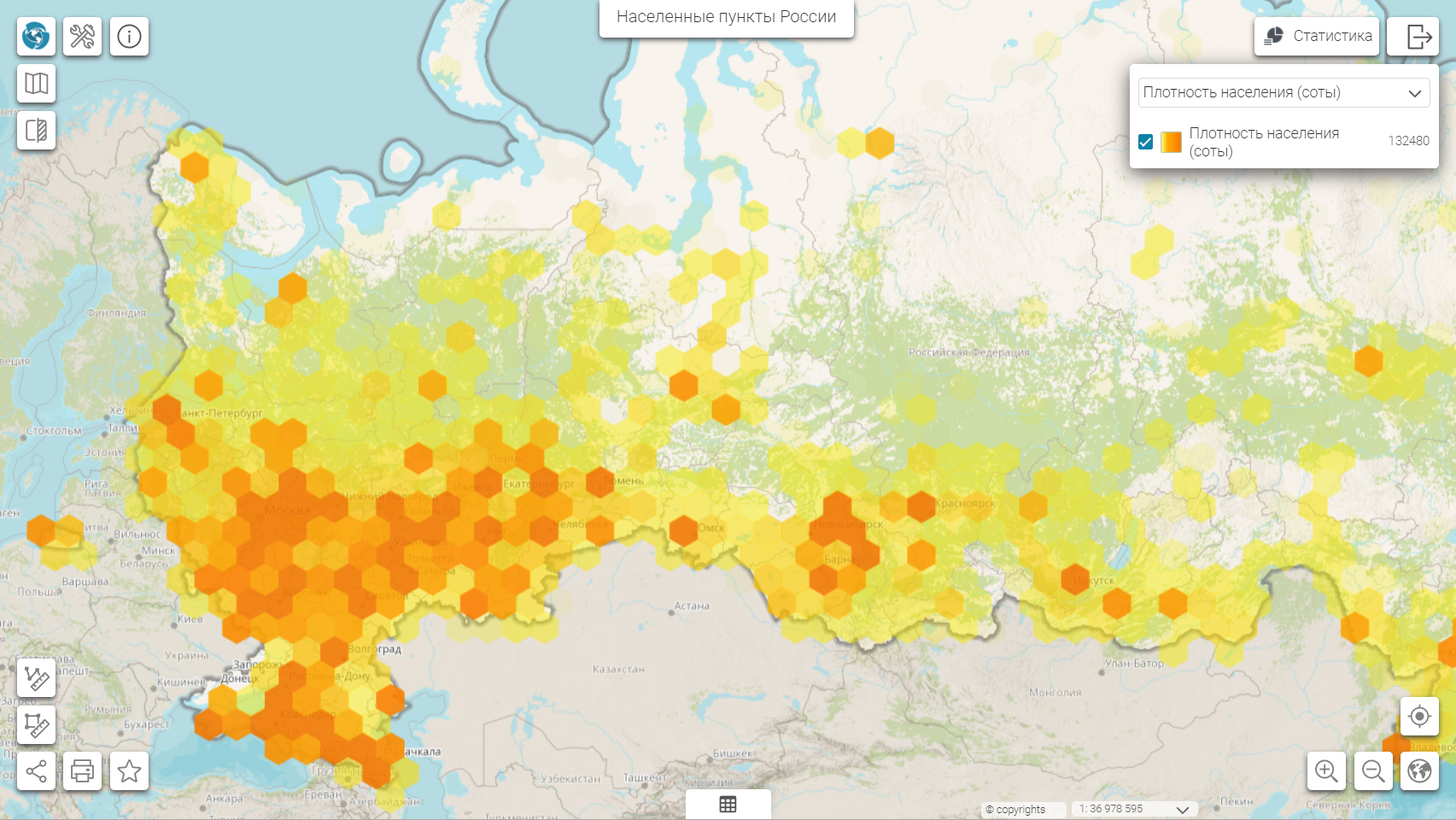
Hexagon-based heat maps
A variety of spatial information display styles allows you to choose the most optimal variant for rendering of your layer objects. CoGIS 11 introduces the hexagon-based heat map rendering option. This map display style has clear segmentation of the displayed data and is often used in operational monitoring centers and in presentations.
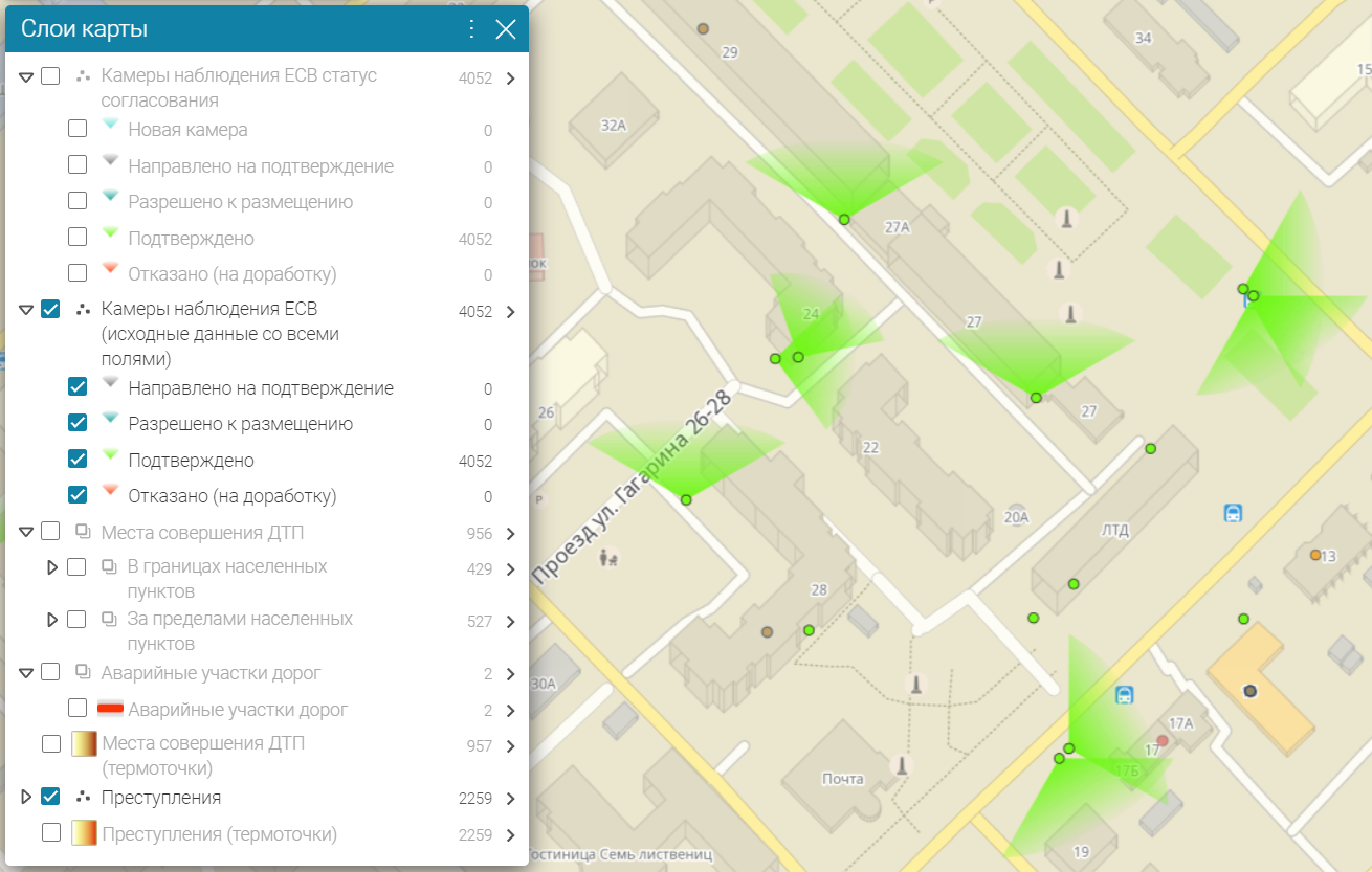
New layer rendering style: Viewing angle
A new rendering style, Viewing angle, which can be applied to point layers, has been added. The new style allows you to visualize the angular coverage based on the parameters specified in the point object properties, for example, to display the video cameras’ location data with specification of rotation angle and coverage angle of each camera.

Geoprocessing based on Python scripts
The geoprocessing is the most important tool for organizing automated workplaces for processing geospatial data. In CoGIS 11, geoprocessing can be performed not only using models, but also Python scripts.
For ease of writing Python scripts, CoGIS introduces the built-in text editor with syntax highlighting, which significantly simplifies and speeds up scripts editing.
Domains with categories
The domains are indispensable when working with registers and lists, since their use significantly simplifies the input and correction of data and allows you to avoid entering incorrect field values when editing objects.
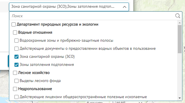
For greater clarity and ease of use, a mechanism for setting up and displaying hierarchical domains was added to CoGIS, which allows you to distribute selected elements of the directory into separate groups.
Interactive map control settings window
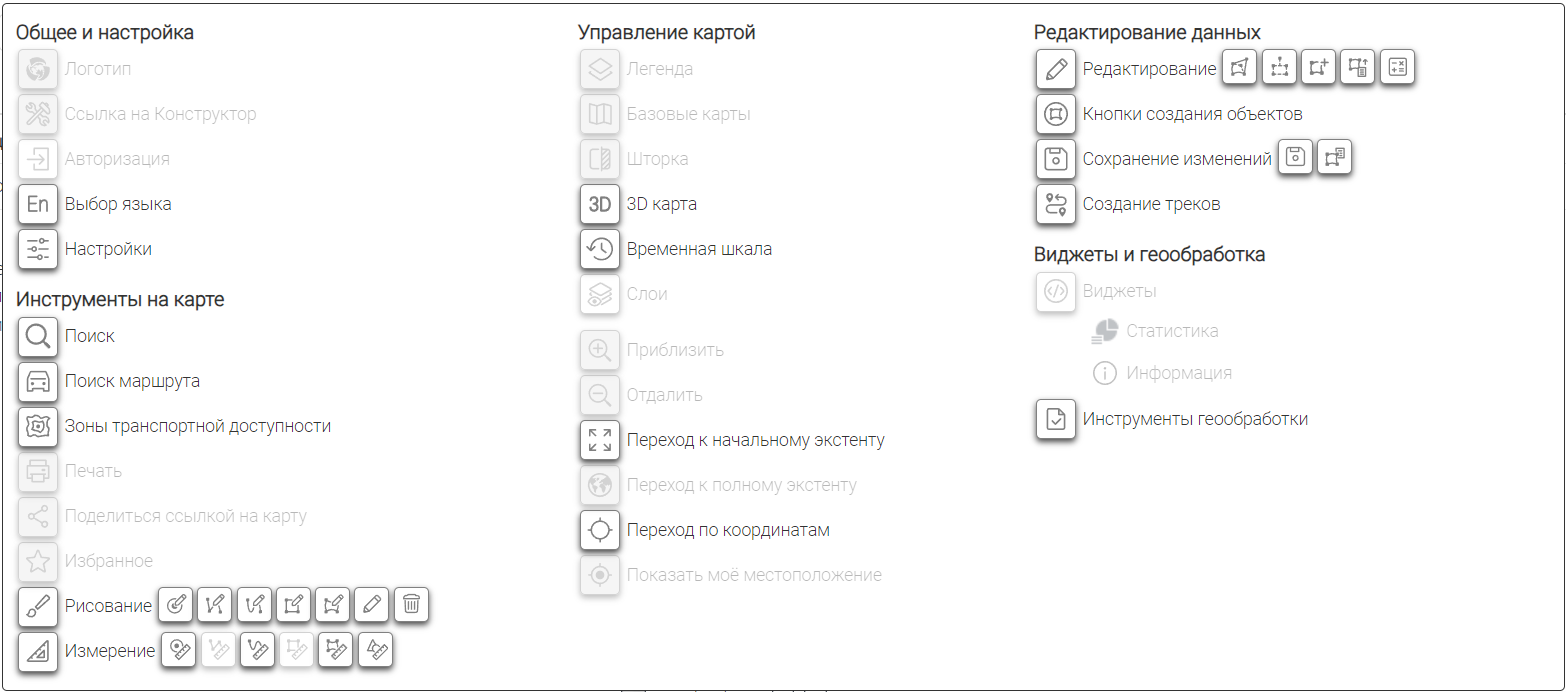
For ease of control elements arrangement in the map window, a new window with all available options has been implemented in CoGIS Designer. Some of the elements are combined into groups, so you can add either the entire tool group or specific tools if needed.
Updated UI
The user interface of GIS portal and CoGIS Designer has been significantly redesigned, including reworked controls, updated fonts, offsets and some elements location. The new settings sections have been added and the logic of some existent sections have been redesigned to improve overall settings management.
The updated interface is now more user-friendly owing to the improved logic of settings and features location and the new eye-pleasing design of dialogs and other elements.
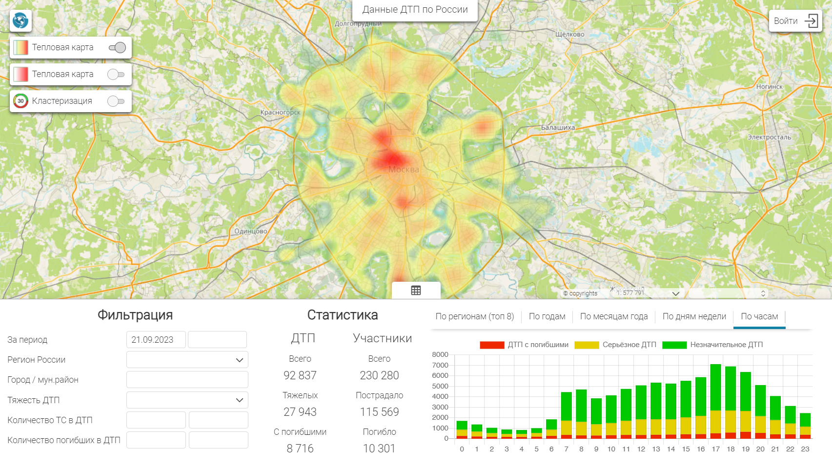
New type of bar diagrams
In CoGIS 11, the set of visual elements to display statistical data has been replenished with the new diagram type - the XY diagram. Now, when configuring widgets on the map, you can also use XY diagrams to visualize data of your map applications.
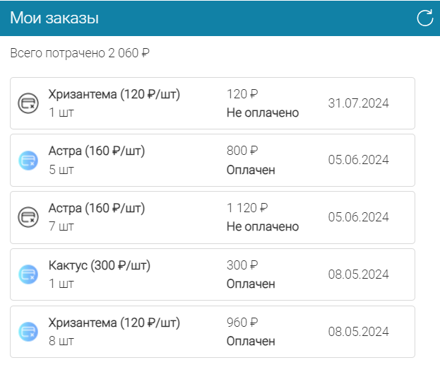
Designing table records with tiles
A new element for designing table records has been added. Now, table rows can be displayed as separate tiles (panels) to better visualize information about the objects.
Full list of changes in CoGIS 11
Portal
- Administration
- The "Scheduled task execution" section with a management interface in the portal settings has been implemented.
- The list of supported digital signature certificate formats has been extended with PEM, PFX, and CryptoPro container.
- The ability to specify adjacent servers with one authorization system has been added.
- The ability to specify IP addresses from the "white list" for access to special administration functions has been added.
- The ability to specify which fields from user accounts are public has been added.
- The ability to change the link that is accessed by click on the button to go to the catalog from the interactive portal map has been added.
- CoGIS Designer
- The ability to add macros by parameters passed via URL has been added.
- Improved user interface for selecting controls when creating available interactive map features.
- Improved support for template maps by URL.
- When using the "Link to map" catalog element it is now possible to define its behavior, i.e., to redirect to the target map or open the target map by the current link.
- Improved and updated user interface: fonts, icons, etc.
- Expansion options
- The ability to expand individual interactive maps using HTML / JavaScript blocks has been added.
- The ability to change the identification and search functions to a non-standard implementation using the PCC example has been added.
- Maps catalog
- The new ‘”compact view” option to display the list of maps of the block/folder in the catalog has been added.
- Reports
- Extended support for office packages for creating report templates: LibreOffice.
- The ability to create a report on child objects and insert child reports for each object, including a map in the report on the parent object has been added.
- Improved function of adding QR codes to reports.
- The ability to call the geoprocessing tool after creating a report has been added.
- The ability to set several steps of report post-processing has been added.
- Improved data pre-processing capabilities for a report.
- The new optional report parameter "Report type" has been added.
- The ability to add the centroid coordinates of object geometries to the report with the ability to format has been added.
- The new report parameter in the post-processing section "Group name for sequential call", which ensures that only one instance of the launched program is launched in parallel has been added.
- The ability to use reference books defined in CoGIS Designer in reports has been added.
- The new operator "between" when setting report filters has been added.
- Widgets
- The new type of displaying objects from the list- tiles has been added.
- The notification in the widget when data in the database changes has been added.
- The new bar diagram type - XY diagram has been added.
- The ability to display the number of found objects in the source data has been added.
- Extended ability to control the widget stripe visibility depending on the layer visibility on the map.
- The ability to quickly create objects using widgets has been added.
- The ability to hide blocks when there is no data has been added.
- The ability to generate messages about the presence or absence of data in the widget stripe by specifying HTML code has been added.
- The option to display the number of groups when grouping is enabled in the attribute table window.
- The ability to control the font size of the widget element headers has been added.
- The ability to hide the clear link for the attribute filter of the widget stripe has been added.
- Improved support for a specified style for unique layer values in the default chart coloring.
- Map, legend, search, identification
- The ability to import data from several layers at a time has been added.
- Improved data import preserving the original coloring specified in files of some data formats.
- The mode for tracking the device location on the map when using the web map has been added.
- Improved support for using multiple tile map services with different origin points that do not match the one specified in the basemap service.
- Improved display of the quick filter button as a switch.
- The ability to configure copying of layer visibility with inversion has been added.
- Improved display of the selected object when changing the scale.
- The new macros {CurrentUserCookieId} and {CurrentBrowserCookieId} have been added to the set of macros.
- Improved display of current mouse coordinates on the map.
- The ability to hide layers without objects in the legend has been added.
- The ability to control the importance of search results by address relative to other results has been added.
- The ability to set the default coordinate system has been added.
- The ability of snapping to vertices of existing objects in the measurement mode has been added.
- The function of switching to the layer coverage when using WMS services has been added.
- The ability to specify quarters when defining time period ranges has been added.
- The ability to send time in UTC when using time data has been added.
- The ability to hide the switch when setting the layers visibility using separate buttons has been added.
- The ability to replace or remove the created object’s label has been added.
- Geoprocessing
- The ability to color the graphic layer based on the geoprocessing tool results for the published map service layer has been added.
- Object card
- Implemented highlighting of object geometry nodes on the map.
- Implemented counting of related/child objects in the parent object card block.
- Improved setting of the visibility condition for tabs and blocks in the object card.
- Implemented active actions by click on the child object line: opening the object card or zooming to the object on the map.
- The "Refresh" button has been added to the object card.
- The ability to set the button visibility in the object card by specifying the countable expression has been added.
- The ability to specify the general part of the filter to control the visibility of stripes/sections of the object card has been added.
- The ability to set the list of attributes shown in the object’s edit history has been added.
- Editing
- The ability to add the object geometry check for intersections/overlaps/occurrences with other objects before saving the object has been implemented.
- The ability to set object parameters through import and third-party preprocessing of data using geoprocessing tools has been added.
- The ability to upload the object geometry to a file by calling the geoprocessing tool has been added.
- Improved "Setting geometry by other objects" tool: the ability to transfer not only the geometry, but also the attributes of the selected object according to certain rules has been added.
- Support for fields of Boolean type has been added.
- The ability to view and edit M coordinates in the object card has been added.
- The ability to set reference books of cascade values with custom grouping has been added.
- Implemented the opening of an information modal window when saving changes to object data.
- The ability to override the geometry and the mandatory geometry of a child object in the parent object card has been added.
- The ability to configure the mandatory addition of links with child objects when creating a parent object has been added.
- Improved ability to define field visibility conditions when editing.
- The ability to reopen the current object card if object creation is canceled in another layer has been added.
- The ability to group quick object creation buttons has been added.
- The ability to limit "Setting geometry by other objects" only to objects of selected layers has been added.
- The ability to define visibility of child object block depending on object attribute values has been added.
- The ability to configure the option to check the visibility condition of buttons - when opening the object card or upon any change.
- The ability to place buttons in the object card in a specific stripe or tabs has been added.
- The ability to snap object to its vertex has been added.
- The ability for overridden "Edit" and "Copy object" buttons in the object card has been added, now when you click the button, the value of the specified attributes is overridden.
- The ability to exclude certain fields when cloning the object has been added.
- The ability to reopen the object card in edit mode after saving has been added.
- The ability to ignore input restrictions when using a special create/save button has been added.
- The new JavaScript call block after creating/saving the object has been added to the portal.
- The option to reopen the current object card in case of canceling the object’s creation in another layer from the card has been added.
- The new option for checking the object’s geometry when using a special create/save button has been added - check for the presence of geometry.
GIS server
- Administration, security
- Support for LDAP integration, including user and group information, without third-party tools (OAuth 2.0/OpenID Connect) has been added.
- The new setting for deleting sensitive login/password information from QGS map project files when loading and uploading has been added.
- The new mechanism for logging into the GIS Server Administrator console for emergency cases when there is physical access to the server file system has been added.
- The columns for recording creation and last modification dates for user and group accounts have been added.
- The display of the number of running and expected geoprocessing tasks and the ability to stop and delete the running tasks have been added.
- The display of currently running requests to the GIS server has been added.
- The ability to configure rules for replacing external URLs has been added.
- The setting to specify the number of rendering threads used for isolates has been added.
- The option of automatic restart of failed services has been added.
- The ability to define the white list of IP addresses for access to settings available only to administrators has been added.
- The security tokens are now created via POST requests only.
- The .NET framework has been changed to .NET 8 (.NET 6.0 life cycle has been completed).
- Publication of services, formats, objects
- Improved support for TAB/MIF/MID, GDAL is not used anymore.
- Improved support for MS SQL Server, including from Linux.
- The option of publishing services based on DXF/DWG files using the caching mechanism has been added.
- The automatic recovery of closed connections to DBMS has been implemented.
- Added support for object link attributes.
- Implemented support for reading PRJ files to determine coordinate system for rasters that do not contain binding information.
- Possibility to assign a custom coordinate system for map services and geoprocessing services by specifying a PRJ file or a PROJ/WKT string has been added.
- The ability to configure a limit on the number of records returned for object search and identification queries has been added.
- The new Densify method has been added to the geometry service.
- The ability to specify the oid field, geometric field, geometry type, and coordinate system for a layer based on a database view has been added.
- Map rendering
- The ability to combine multiple layers with multiple rendering styles at different scales has been added.
- Support for built-in coloring of TAB, MID/MIF, DWG, DXF file formats with automatic conversion to coloring by unique values has been added.
- The new hexagon-based heat map rendering style has been added.
- The new layer rendering style - viewing angle has been added.
- The ability to render geometry node number labels has been added.
- The ability to use object label callouts on the map has been added.
- The ability to format label text based on date/time fields has been added.
- Tiles
- Added support for MBTiles (MapBox Tiles) as a raster layer source.
- The ability to clear the tile cache has been added.
- Geocoding
- The ability to limit the output of geocoding results based on the estimated weight (score) has been added.
- The ability to navigate by coordinates in the search bar has been added.
- Geoprocessing
- The ability to write Python scripts to create geoprocessing tasks has been added.
- The new visual text editor for Python scripts with syntax highlighting has been added in the GIS server administrator console.
- Added support for print service templates based on QPT files.
- The new geoprocessing tool for exporting a map to a file has been added.
- The new geoprocessing tool for synchronizing data from OData sources (SharePoint, SAP) has been added.
- Added support for basic authorization for the geoprocessing tool for getting layer/map via WFS service.
- The ability to configure fields mapping for the geoprocessing tool for synchronizing objects in a layer has been added.
- The new geoprocessing tool for importing object geometry with row-by-row coordinates from XLSX, CSV has been added.
- Added support for importing exchange format files with geometries of different types.
- The new geoprocessing tool for calculating statistics has been added.
- The new geoprocessing tool for converting object geometry types has been added.
- The function for checking geoprocessing tool libraries has been added.
- The new geoprocessing tool for comparing two layers by attribute or spatial criteria has been added.
- The new geoprocessing tool for importing feature geometries from files of various formats has been added.
- The new geoprocessing tool for obtaining points along a polyline with a specified step has been added.
- The new geoprocessing tool for determining the extent of a layer/map has been added.
- The new geoprocessing tool for determining the type of geometry has been added.
- The ability to search for a layer by its serial number in the geoprocessing tool for finding layers in a map has been added.
- The ability to use a geodetic buffer in the geoprocessing tool to create a buffered layer of spatial features has been added.
- The new geoprocessing tool for generalizing the geometry of layer features has been added.
- The new geoprocessing tool for sequentially combining records from multiple tables has been added.
- The new geoprocessing tool for building an index by table fields has been added.
- The new geoprocessing tool for adjusting geometries in a layer has been added.
- The new geoprocessing tool for calculating geometric parameters based on the geometry of layer features has been added. The new geoprocessing tool to split long sections of geometry at a specific step has been added.
- The new geoprocessing tool to add and populate a field with UUID values has been added.
- Editing, SOE, geotriggers
- The option to divide SOE rules into several files has been implemented.
- The ability to export the layer attribute table to the FileGDB format has been added.
- Improved management of the editing objects option.
- The new type of geotrigger for executing a SQL query has been added.
- The new type of geotrigger for running a geoprocessing tool has been added.
- The new type of geotrigger for running an external library function has been added.
- The concept of template geotriggers has been implemented.
- The ability to specify users and user groups as addressees when configuring a geotrigger for sending messages.
- The ability to limit the number of points to output object geometry when outputting search results and identifying objects has been added.
- The ability to hide the author of created changes to objects in the change history has been added.
Payment module
- The basic functionality of the payment module has been implemented.
- Simultaneous support for several payment gateways has been added.
- Support for the monei.com payment gateway has been added.
- The ability to configure the payment module via the web interface has been added.